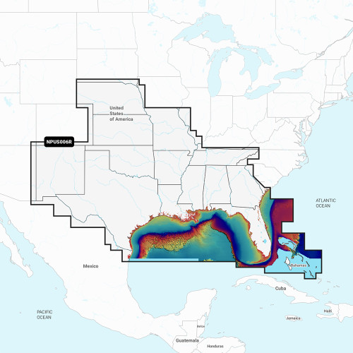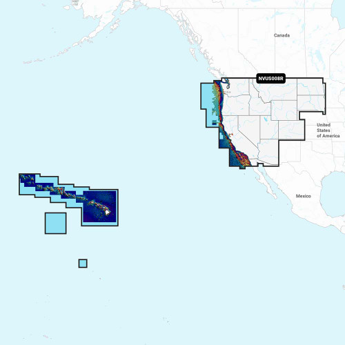


Description
Garmin Navionics Vision+ U.S. North | Boat Supply Store
Navigate the complex waterways of the U.S. North with unparalleled detail. This cartography solution integrates Garmin's and Navionics' leading datasets, providing 1' HD bathymetry for precise depth awareness and advanced dock-to-dock route guidance. Achieve optimal fishing performance with specialized features like Fishing Range and Shallow Water Shading, all supported by daily chart updates for critical accuracy.
Key Features
- Integrated Garmin and Navionics® content for comprehensive coverage.
- Daily chart updates ensure the most current navigational data.
- Advanced dock-to-dock route guidance simplifies complex voyages.
- Community Edits layer offers user-sourced navigational enhancements.
- SonarChart™ HD bathymetry maps with up to 1' contours for superior underwater terrain visualization.
- Fishing Range feature aids in identifying optimal fishing zones.
- Shallow Water Shading highlights critical navigational hazards.
- SonarChart™ Live capability for real-time seabed mapping.
Specifications
| Product Specifications | |
|---|---|
| Cartography Type | Garmin Navionics Vision+™ NVUS005R U.S. North |
| Storage Media | microSD™ card |
| Content Integration | Garmin and Navionics® |
| Bathymetry Detail | SonarChart™ HD (up to 1' contours) |
| Route Guidance | Advanced dock-to-dock |
| Advanced Features | Fishing Range, Shallow Water Shading, SonarChart™ Live, Plotter Sync |
| Update Subscription | Annual renewable (first year included) |
Who This Is For
Boaters and anglers requiring highly detailed, continuously updated marine cartography for the U.S. North region. This product is ideal for those seeking advanced navigational aids and fishing-specific tools like HD bathymetry and route planning.
How It Compares
| Feature | Garmin Navionics Vision+ U.S. North | Garmin BlueChart g3 HD |
|---|---|---|
| Coverage Area | U.S. North (Coastal, Lakes, Rivers) | U.S. Coastal |
| Bathymetry Detail | SonarChart™ HD (1' contours) | Up to 1' contours |
| Route Guidance | Advanced Dock-to-Dock | Yes |
| Community Data Layer | Community Edits | No |
| Live Mapping | SonarChart™ Live | No |
Common Concerns Answered
Is the annual subscription for updates expensive?
The subscription cost for annual updates is a factor for some users. However, the first year of updates is included, and the ongoing subscription ensures you always have the most current and detailed navigational data available.
Is this difficult to set up or learn?
While the initial setup is straightforward as it's a microSD card insertion, fully leveraging all advanced features may require a learning curve to maximize its benefits for navigation and fishing.
What if I don't need annual updates?
The annual subscription is renewable, not mandatory for continued basic functionality. However, to maintain the highest level of accuracy and access new features, updating is recommended and the first year is included with your purchase.
Frequently Asked Questions
What is Garmin Navionics Vision+™ NVUS005R U.S. North?
It is a marine cartography product from Garmin that combines highly detailed Garmin and Navionics® data for the U.S. North region, featuring 1' HD bathymetry and advanced navigation tools on a microSD card.
What are the key features of the Garmin Navionics Vision+™ NVUS005R U.S. North?
Key features include integrated Garmin and Navionics® content, daily chart updates, advanced dock-to-dock route guidance, Community Edits, SonarChart™ HD bathymetry (up to 1' contours), Fishing Range, Shallow Water Shading, SonarChart™ Live, and Plotter Sync.
What chartplotters are compatible with the Garmin Navionics Vision+™ NVUS005R U.S. North?
Compatibility is with select Garmin chartplotters that support Navionics+ cartography. Refer to the Garmin website manual for a detailed list of compatible models.
How do I update the charts on my Garmin Navionics Vision+™ NVUS005R U.S. North?
Updates can be performed via the Navionics® Chart Installer software on a PC or directly on a compatible chartplotter using Plotter Sync.
What is SonarChart™ HD bathymetry?
SonarChart™ HD bathymetry is a high-resolution layer of detailed depth contour data, often with contours as fine as 1 foot, providing a precise representation of the seabed topography for safer navigation and better fishing.