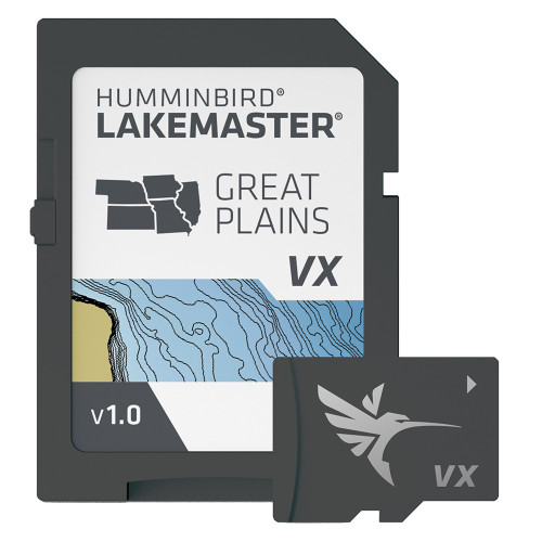


Description
Humminbird LakeMaster VX Great Plains | Boat Supply Store
Navigate and target productive fishing zones with unparalleled accuracy using the Humminbird LakeMaster VX Premium - Great Plains mapping card. This card incorporates advanced VX Technology for superior map rendering and SmartStrike to intelligently identify areas with high fish-probability based on species and season. Featuring customizable Chart Presets and Water Level Offset to synchronize contours with current water levels, it provides essential data for anglers targeting major reservoirs and river systems across the Great Plains.
Key Features
- Unlocks superior map performance with advanced VX Technology.
- Provides intelligent fishing insights with SmartStrike technology.
- Enables easy switching between custom view settings via Chart Presets.
- Highlights productive water depths for targeted fishing with Depth Highlight.
- Facilitates easy identification of hazardous shallow areas with Shallow Water Highlight.
- Synchronizes contour lines with current water levels using Water Level Offset.
- Integrates seamlessly with Minn Kota trolling motors via the One-Boat Network.
- Enhances bottom detail recognition and depth change identification with 2D Shaded Relief and Aerial Imagery.
Specifications
| Product Specifications | |
|---|---|
| Mapping Card Type | Humminbird LakeMaster VX Premium |
| Region | Great Plains |
| Technology | VX Technology |
| Fishing Insights | SmartStrike |
| Customization | Chart Presets |
| Depth Targeting | Depth Highlight |
| Hazard Identification | Shallow Water Highlight |
| Water Level Adjustment | Water Level Offset |
| Connectivity | One-Boat Network |
| Detail Layers | 2D Shaded Relief, Aerial Imagery |
| Compatible Units | Humminbird HELIX G3/G3N and newer, SOLIX, APEX |
| Warranty | 1-year cartography warranty |
Who This Is For
Serious anglers equipped with compatible Humminbird HELIX G3/G3N or newer, SOLIX, or APEX units seeking the most detailed and accurate fishing maps for the Great Plains region. It is designed for those who prioritize advanced features for effective fish location and navigation.
How It Compares
| Feature | Humminbird LakeMaster VX Great Plains | Garmin BlueChart g3 Vision HD |
|---|---|---|
| VX Technology | Yes | No, No |
| SmartStrike Technology | Yes | No, No |
| 2D Shaded Relief | Yes | Yes (part of Vision HD), No |
| Aerial Imagery | Yes | Yes, No |
| One-Boat Network | Yes | No, No |
| Coverage Area | Great Plains | Central US, Great Lakes |
Common Concerns Answered
What if I'm not entirely sure the Great Plains coverage is right for my primary fishing locations?
To mitigate concerns regarding regional specificity, it is critical to confirm that your primary fishing waters are indeed within the designated Great Plains coverage area before purchase. As noted, opened packages are non-returnable, making pre-purchase verification of coverage essential for ensuring product utility.
Is the 1-year cartography warranty sufficient for long-term use?
The 1-year cartography warranty provides coverage for the initial period of use. For users requiring extended warranty protection on their mapping data, it is advisable to contact Humminbird directly regarding any available extended service plans or to consider the long-term value proposition of the detailed features provided.
I've heard SmartStrike accuracy can vary. How reliable is it?
While SmartStrike technology is highly regarded for its intelligent fishing insights, users have reported occasional accuracy variances in highly specific conditions. This advanced feature leverages extensive data to highlight probable fish-holding areas, providing a valuable starting point for anglers, but should be used in conjunction with on-the-water observation and sonar interpretation.
Frequently Asked Questions
What is VX Technology in Humminbird LakeMaster maps?
VX Technology in Humminbird LakeMaster maps enhances map performance through advanced rendering techniques and provides customizable color palettes for improved visual clarity and detail interpretation on compatible Humminbird units.
How does SmartStrike technology work with LakeMaster VX Premium maps?
SmartStrike technology analyzes species, season, and water body data to highlight areas on the map that are most likely to hold fish, assisting anglers in identifying productive fishing locations more efficiently.
What are the benefits of 2D Shaded Relief and Aerial Imagery in LakeMaster Premium maps?
2D Shaded Relief provides a detailed representation of underwater terrain and depth changes, allowing for quicker identification of structure and drop-offs. Aerial Imagery offers an overhead perspective for enhanced navigation and better recognition of shorelines, submerged features, and potential spot locations.
Which Humminbird units are compatible with LakeMaster VX Premium - Great Plains?
Humminbird LakeMaster VX Premium - Great Plains is compatible with Humminbird HELIX G3/G3N and newer, SOLIX, and APEX series fishfinder/chartplotter units.
How does Water Level Offset work with LakeMaster charts?
Water Level Offset allows anglers to adjust the displayed depth contours on the chart to precisely match the current water levels of the lake or river, ensuring that the charted depths accurately reflect real-time conditions.